
 Myanmar boasts the highest proportion of forest cover in mainland Southeast Asia and almost half of the country’s territory is covered by forested land.
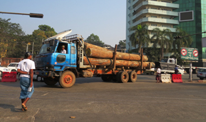
Myanmar’s total forest area was logged at a rate of 310,000 hectares per year between 2005 and 2012. Main drivers of deforestation are agricultural conversion, fuel wood, charcoal consumption, and commercial logging. National deforestation estimates are mapped estimates shown in hectares (Dark Brown).